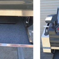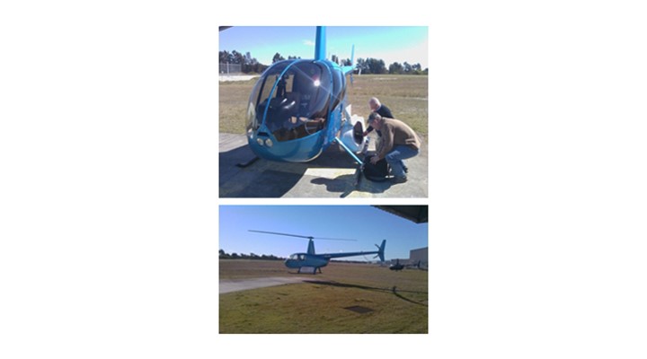
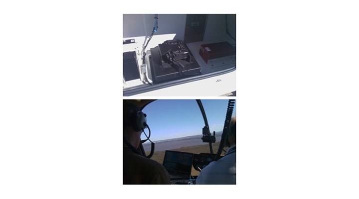
NSW Fisheries will use the data of the helicopters dynamics to more accurately overlap their images in their post processing software hence generating a more accurate coastal features map. The information from these maps will be used to monitor ecological trends in the estuaries and mangroves and how these trends are affecting the marine environment.
- Suppliers
- New to IndustrySearch? Book a Demo
- Advertise with us
- Login
- Email Marketing
- Buyers
- Get Quotes
- Articles & Ideas
- Login
- Subscribe to newsletter
- My Details
- Get Quotes
- Automation & Control
- Automotive Workshop Equipment
- Commercial Cleaning Equipment & Supplies
- Construction Equipment & Heavy Machinery
- Conveyor Systems & Components
- Electrical & Power Generation Equipment
- Electronic Components
- Farming & Agriculture
- Food & Beverage Processing
- Forklifts & Forklift Attachments
- Hydraulic & Pneumatic Equipment
- Industrial Materials, Tools & Components
- Industrial Pumps
- IT Hardware & Industrial Computing
- IT Software & Applications
- Laboratory Equipment & Instruments
- Manufacturing & Industrial Equipment
- Material Handling & Lifting Equipment
- Metalworking & Machining
- Mining Equipment & Machinery
- Packaging & Labelling Machinery
- Pallet Handling Equipment
- Personal Protective Equipment
- Security & Surveillance
- Test & Measurement
- Transport & Logistic Equipment
- Warehouse Storage, Shelving & Racking
- Waste Treatment & Environmental Management
- Welding Machines & Accessories
- Woodworking & Joinery Machines
- Workplace Equipment
- Workplace Safety Equipment
Trusted by 1,000,000+ Australian industrial buyers
Buyers
- Discover products & solutions
- Login
- Subscribe To Newsletter
- Browse All Products
- Read Articles
Suppliers
Advertise
- Promote your products & solutions
- New to IndustrySearch? Book a Demo
- Login / Forgot Password
- Advertise Your Products
- Success Stories
- Email Marketing
- Suppliers
- Advertise with us
- Login
- Email Marketing
- Buyers
- Get Quotes
- Articles & Ideas
- Login
- Subscribe to newsletter
- My Details
Get Quotes
- Automation & Control
- Automotive Workshop Equipment
- Commercial Cleaning Equipment & Supplies
- Construction Equipment & Heavy Machinery
- Conveyor Systems & Components
- Electrical & Power Generation Equipment
- Electronic Components
- Farming & Agriculture
- Food & Beverage Processing
- Forklifts & Forklift Attachments
- Hydraulic & Pneumatic Equipment
- Industrial Materials, Tools & Components
- Industrial Pumps
- IT Hardware & Industrial Computing
- IT Software & Applications
- Laboratory Equipment & Instruments
- Manufacturing & Industrial Equipment
- Material Handling & Lifting Equipment
- Metalworking & Machining
- Mining Equipment & Machinery
- Packaging & Labelling Machinery
- Pallet Handling Equipment
- Personal Protective Equipment
- Security & Surveillance
- Test & Measurement
- Transport & Logistic Equipment
- Warehouse Storage, Shelving & Racking
- Waste Treatment & Environmental Management
- Welding Machines & Accessories
- Woodworking & Joinery Machines
- Workplace Equipment
- Workplace Safety Equipment
Trusted by 1,000,000+ Australian industrial buyers